|
Home
Free Maps
Store
ORV Trail Maps
Snowmobile Trail Maps
Outdoor Recreation Maps
Service/Support
Contact
Privacy Policy
About Us
Mailing List
|
| Information on Mio ORV Route
Back to Main Trail Info Page   
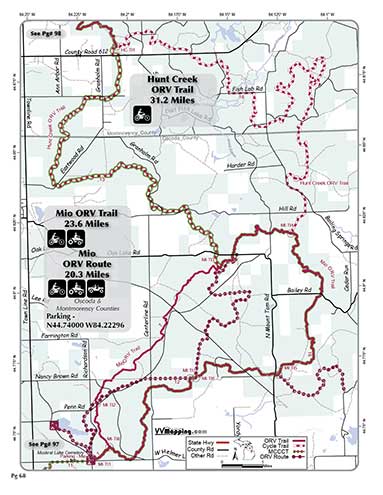
Mio
Pg# 68 (PDF)
Width: 72"
Length: 20.3
Traffic: Some
County Rds Open to ORVs: Yes
Forest Rds Open to ORVs: No
ORV Route. Sandy, some rocks on generally rolling to hilly terrain.
Connects to Muskrat Lake State Forest Campground (currently closed).
Modern staging area. See also Mio Trail.
Located in Oscoda county which allows ORVs on it's roads.

|
|
Information about this page Information regarding ORV use in Michigan
Trail Guide at a glance
Big Picture of trail locations
Map Book Information
GPS Map Information 
This work is licensed under a Creative Commons Attribution-Noncommercial-No Derivative Works 3.0 License
|


