|
Home
Free Maps
Store
ORV Trail Maps
Snowmobile Trail Maps
Outdoor Recreation Maps
Service/Support
Contact
Privacy Policy
About Us
Mailing List
|
| Information on Atlanta ORV Trail
Back to Main Trail Info Page  
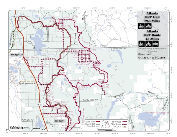
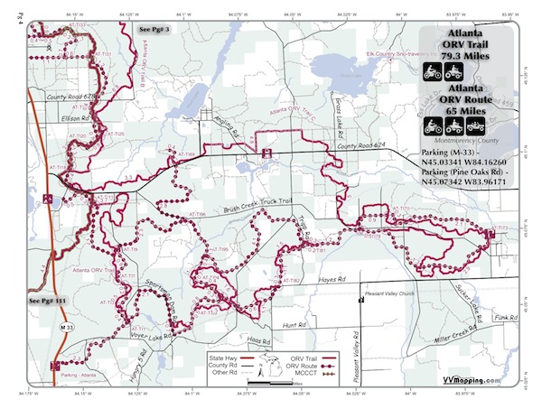
Atlanta
Pg# 1-2 (PDF
1, PDF
2)
Width: 50"
Length: 79.3
Traffic: Some
County Rds Open to ORVs: Yes
Forest Rds Open to ORVs: No
ORV Trail, several loop options. Varies from flat & sandy to
hard pack & hilly. Some rocks. Can be whooped. Varies from
jack pine scrub to mature (open) hardwood stands. Direct fuel & food
access via ORV Route to facility on M-33. Direct access to Clear Lake State Park as well as Jackson
Lake State Forest Camground. Modern staging area on M-33 next to
DNR Atlanta Office. Located in Presque
Isle & Montmorency counties
which allow ORVs on county roads. See also the Atlanta
ORV Route.
|
|
Information about this page Information regarding ORV use in Michigan
Trail Guide at a glance
Big Picture of trail locations
Map Book Information
GPS Map Information 
This work is licensed under a Creative Commons Attribution-Noncommercial-No Derivative Works 3.0 License
|